Transalpina (DN 67C) is a national road in the Parâng Mountains, Southern Carpathians, being the highest road in Romania, with the highest point in Urdele Pass (2,145 m). It connects the towns of Novaci (Gorj) and Sebeș (Alba) and is closed in winter.
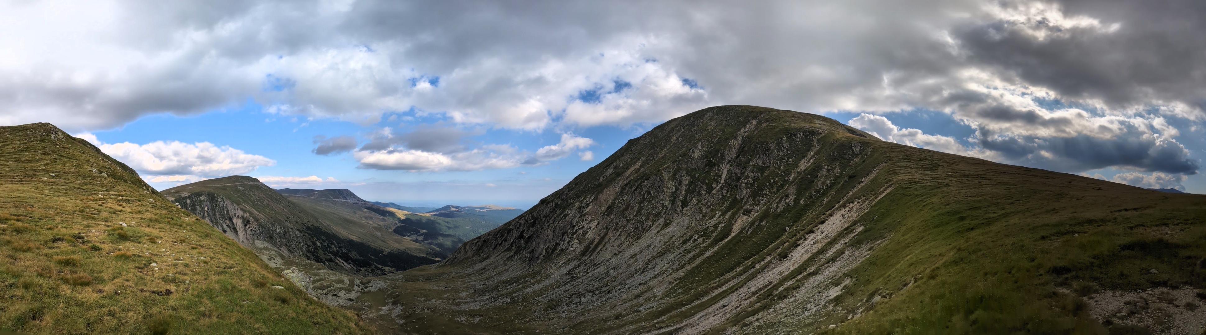
Transalpina crosses four counties: Gorj, Vâlcea, Sibiu and Alba, crossing the Parâng Mountains. The highest altitude is found on a 20 km stretch in Gorj and Vâlcea, near the peaks of Dengheru, Păpușa, Urdele, Iezer and Muntinu.
The origins of the road are unclear. Some sources indicate the construction by the Roman legions during the wars with the Dacians, others say it was built by the locals in the 18th-19th centuries. The Germans rebuilt and paved the road in World War I, but it was little used.
Initially, Transalpina was a mountain path used by shepherds from Mărginimea Sibiului. Austrian authorities proposed the construction of a Transcarpathian road in 1731. King Charles II wanted a strategic road, and work began in 1934 and was completed in 1939.
During the Second World War, the road was rehabilitated by the Germans. After the 1989 revolution, the road was neglected, and in 2008 it was decided to rehabilitate it. Work began in 2009 and was partially completed in 2010.
The modernization of the road was stopped in 2013 due to the insolvency of the contracted company. The Rânca-Obârşia Lotrului and Obârşia Lotrului-Oașa Dam sections have been partially rebuilt, but safety elements are missing. The road is considered a work in progress and does not benefit from complete snow removal.
Transalpina was officially reopened on August 15, 2015 between Rânca and Obârsia Lotrului, but traffic is only allowed during the day, as a construction site. On 11 June 2016, it reopened between km 34+500 and km 59+800, with limited access between 7am and 8pm and a maximum speed of 30km/h.
//
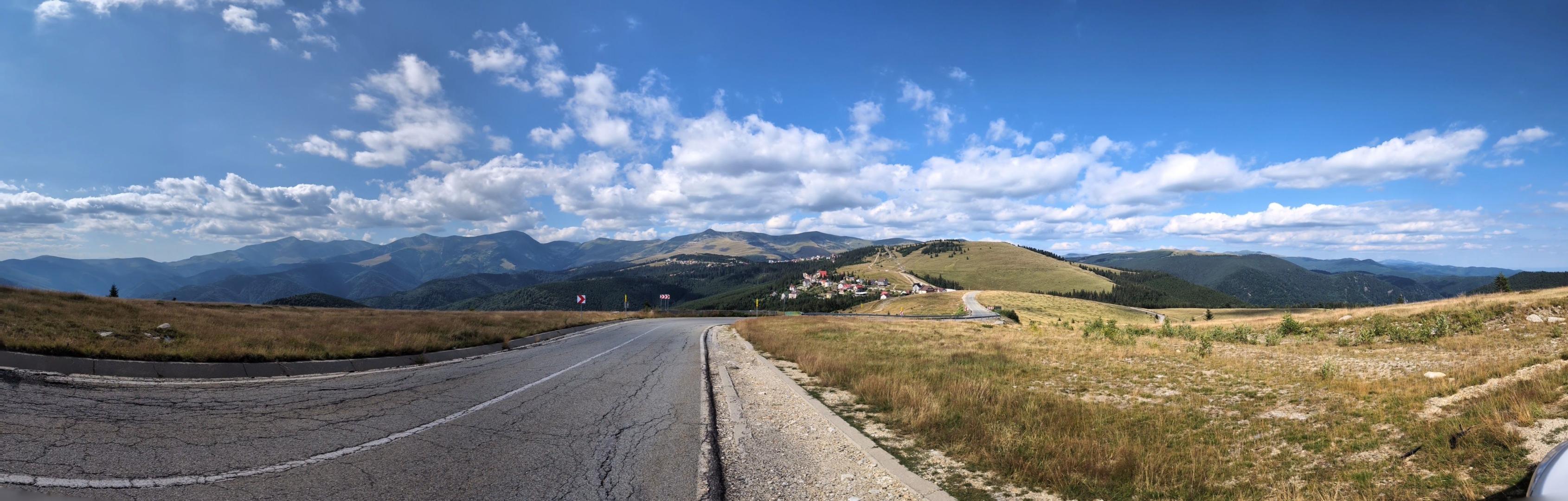
The Parâng massif is crossed by the Transalpine highway in the South-North direction, with a total length of 150 km. It starts from Târgu Jiu, passes through Novaci, reaches the Rânca resort, crosses the source of the Lotru River and the Urdele pass (located at 2,145 m altitude), then continues through the area of the Oaşa lake and dam, to Sebeş, connecting Oltenia and Transylvania.
Of the 148 km of the highway, 20 km form the ridge portion, which reaches a maximum altitude of 2,145 m near the Urdele peak (located at 2,228 m), in the Urdele pass area, representing the highest road in Romania.
There are various hypotheses regarding the origin of this mountain road, some suggesting that it was built by the Roman legions or by the Habsburg Empire. However, it seems that the road represents an old transhumance route used by Transylvanian shepherds to reach Oltenia, being modernized between 1934-1939 by the Romanian Government, under the leadership of Gheorghe Tătărescu.
Between 2009 and 2013, the Transalpine Highway underwent an extensive modernization process, including route adjustment works, widening, asphalting and installation of safety elements, such as parapets, reflective signs, road markings and gutters for draining water from the slopes. The road was officially inaugurated on August 15, 2015.
Sursa: romaniadategeografice.net